
About Munnar
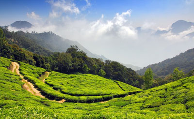
Munnar is a hill station situated above 1600 meter above sea-level in Western Ghats. The name derived because of the confluence of three rivers Madhurappuzha, Nallathanni and Kundali. Munnar is situated in Kannan Devan village in Devikulam Taluk, Idukki District. Major railway stations are Ernakulam and Alwaye (approximate distance 140 kilometers) and nearest airport is Kochi (Approximate 105 kilometeres).
Neelakurinji , the flower of the blue mountains
Kerala is blessed with many natural spectacles and among them is a unique canvas that gets unveiled every twelve years in God's Own Country. The phenomenon of once in twelve years occurring on the fabled hills of Munnar is attributed to the blooming of Neelakurinji .The next blooming of this flower is going to be in 2018.
Most of the native flora and fauna of Munnar have disappeared due to severe habitat fragmentation resultant from the creation of the plantations. However, some species continue to survive and thrive in several protected areas nearby, including the new Kurinjimala Sanctuary to the east, the Chinnar Wildlife Sanctuary, Manjampatti Valley and the Amaravati reserve forest of Indira Gandhi Wildlife Sanctuary to the north east, the Eravikulam National Park and Anamudi Shola National Park to the north, the Pampadum Shola National Park to the south and the proposed Palani Hills National Park to the east.
The region in and around Munnar varies in height from 1,450 meters (4,760 ft) to 2,695 meters (8,842 ft) above main sea level. The temperature ranges between 5 °C (41 °F) and 25 °C (77 °F) in winter and 15 °C (59 °F) and 25 °C (77 °F) in summer.[8] Temperatures as low as −4 °C (25 °F) have been recorded in the Sevenmallay region of Munnar.


